Chikatou Fort

History
As for what I'm calling "Chikatō-toride", the site is in a sort of historical limbo as there are no records pertaining to it (Nagano-based yamajiro super explorer Ranmaru lists this site as "Chikatō-jinja no toride"). The evidence for its existence is solely physical, chiefly the rear horikiri. Yet we can reasonably speculate about its history. It appears to have been a satellite fortification of the Hayashijō complex of castles, the medieval fortresses of the Ogasawara Clan. It was likely used as a look-out ("monomidai"). The hill projects out into the plain and grants excellent views of both the flat land and many nearby mountains. A look-out tower was likely built in the upper bailey. Perhaps in future archaeological excavations can unearth more clues.
Visit Notes
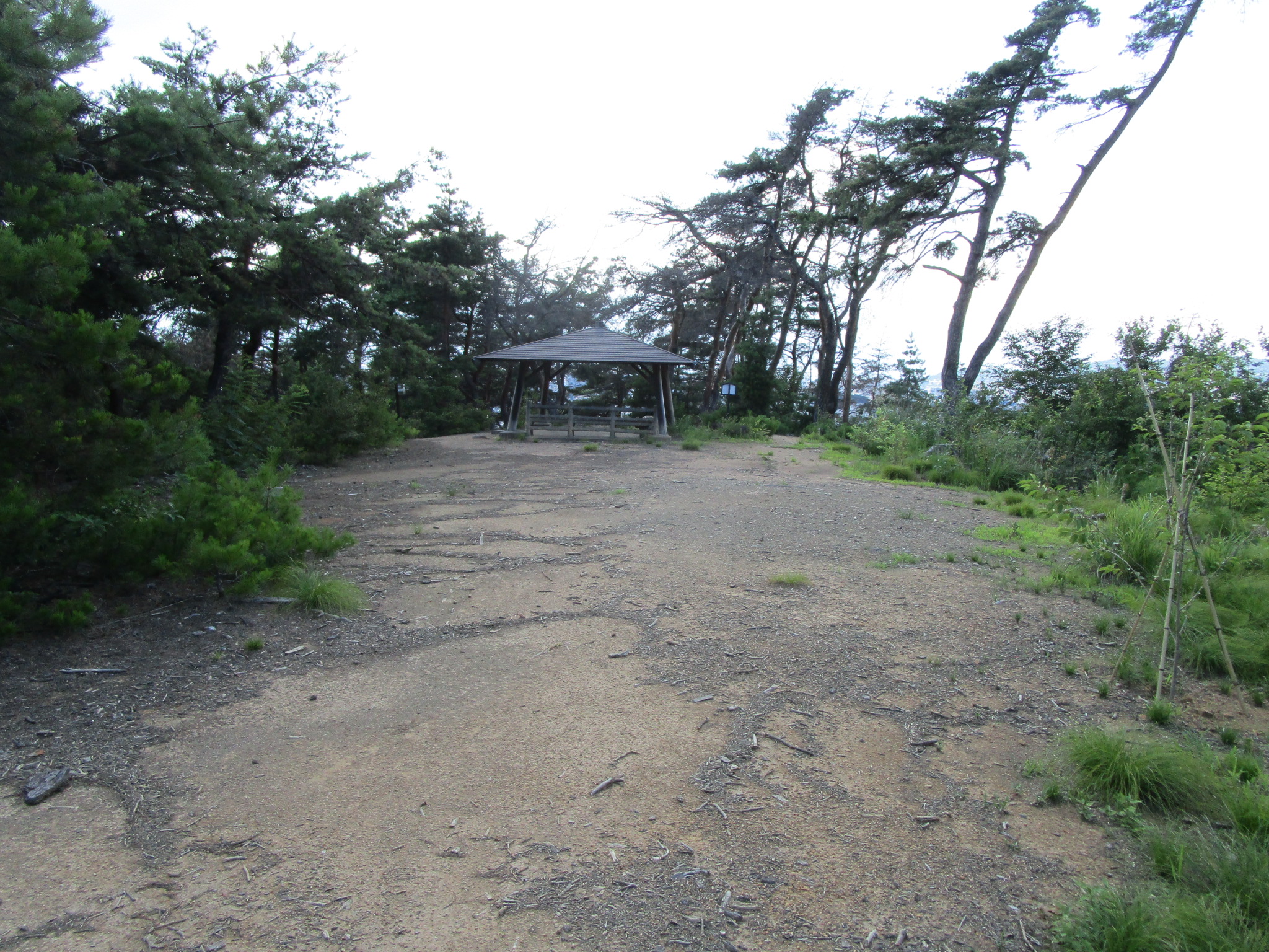
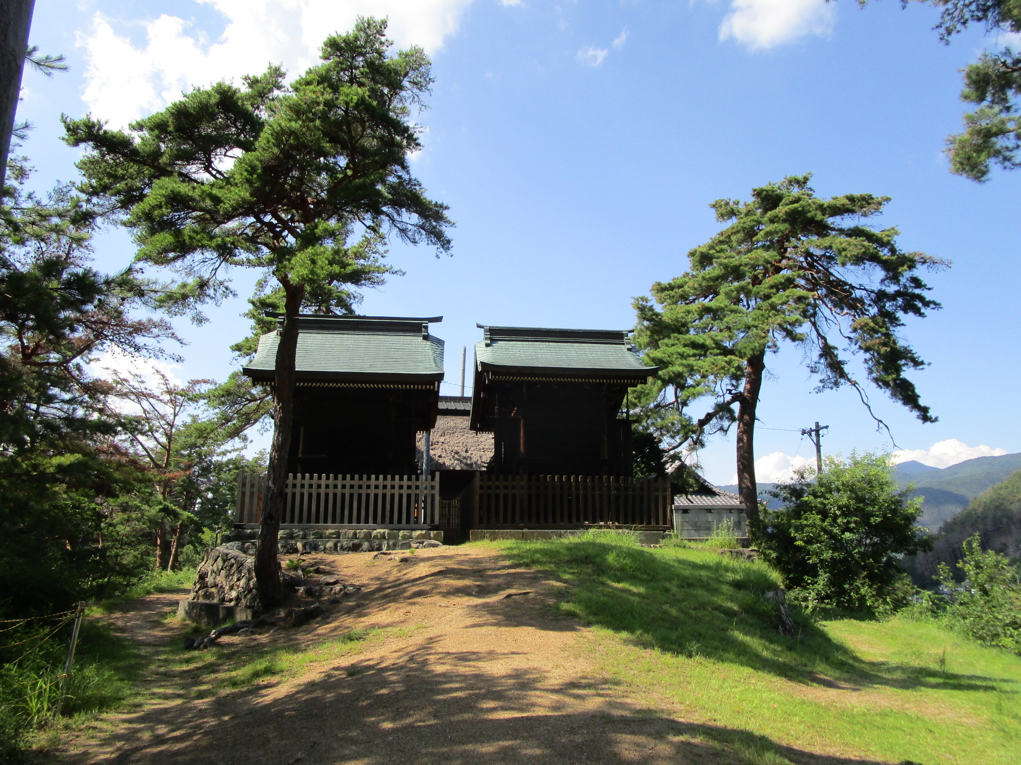
At the back of the "Thousand Deer Heads Shrine (reading is "Chikatō-jinja")" is a horikiri (trench). When I saw it I immediately knew "by jove, this hill was fortified"! Of course, I was happy with this discovery, but I couldn't confirm what I had found until I could get home and research, since the horikiri was the only sure sign of the fort. The horikiri is bridged by a dobashi (earthen bridge). Above it, toward the rear of the shrine, the earth sweeps up, and this may have been a dorui (earthen rampart), an embankment, which has since degraded. The flattened space upon the ridge where the shrine sits is like a kuruwa (bailey). This particular mountain frond rises sharply before it terminates in a hill over-looking the plain. The shrine is in a shallower part of the ridge. I knew I had to climb up to the hilly terminus to check for ruins because if the lower portion was fortified then this hill must've been as well. This hill is the "Mazu no Miya" area, referring to the shrine compex, and the hill itself is the "Thousand Deer Heads Hill". I didn't have proper gear for a hike but the hill wasn't so high and there was a nice path up. There was no obvious sign of previous fortification except for that the hilltop has been flattened. This would be the forward bailey, one of two, then.
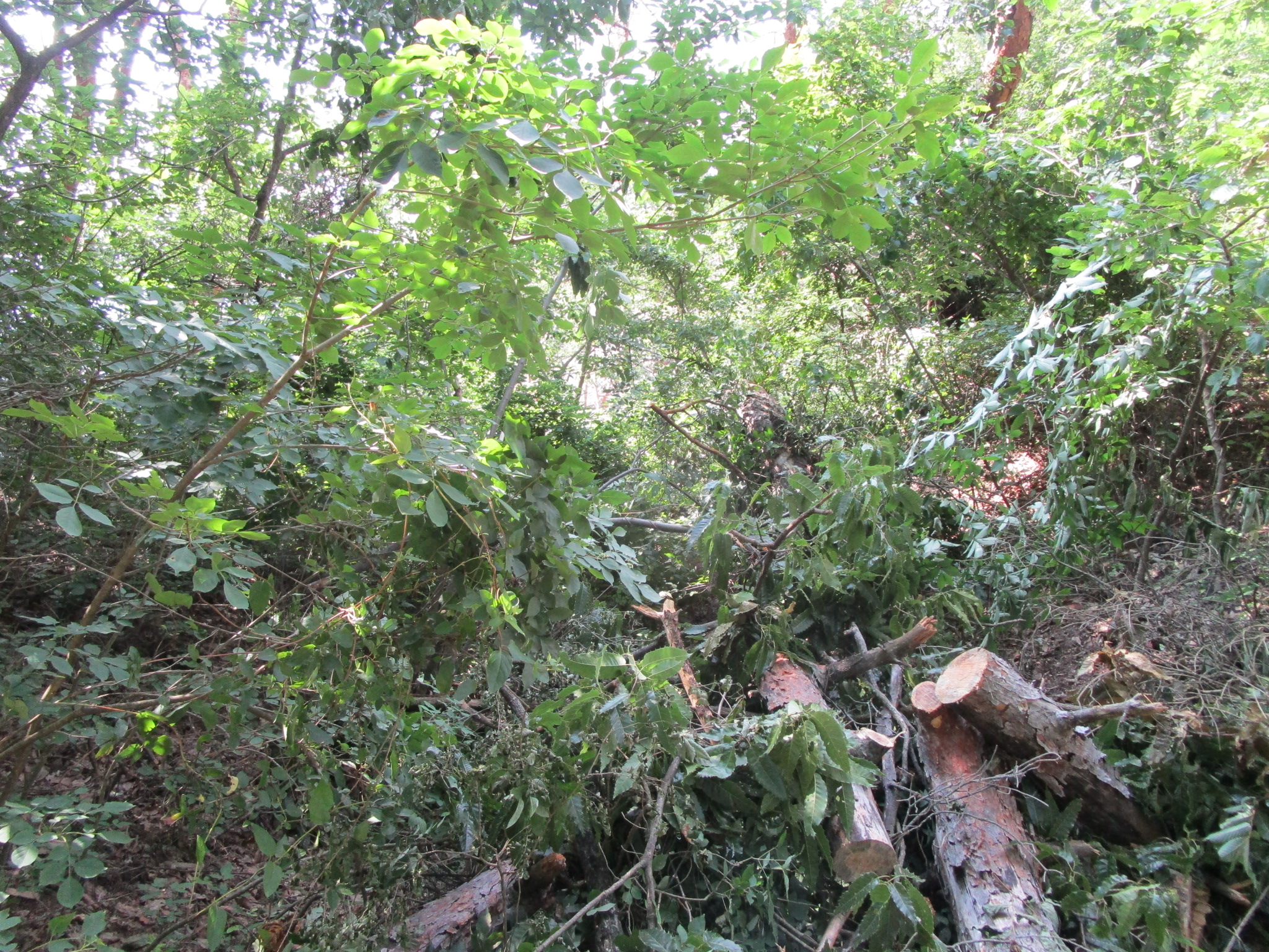
The preserved horikiri is at the very rear of the site, and I thought there may have been a shallower trace of a trench between the two baileys but it was too dense with vegetation on both sides to tell. In fact, the vegetation grew suspiciously thickest in these divots...
This adventure is a testament to a few things. Do not think that I am merely lucky; Shinano is dense with fortification sites no matter where one steps - at least near civilisation. And though I'm happy that I am experienced enough that I can immediately spot an obvious yamajiro (mountaintop castle) feature when I come across it, it appears that there are many hidden sites I haven't uncovered yet.


| Castle Profile | |
|---|---|
| English Name | Chikatou Fort |
| Japanese Name | 千鹿頭砦 |
| Founder | Ogasawara Clan |
| Year Founded | Sengoku Period |
| Castle Type | Mountaintop |
| Castle Condition | Ruins only |
| Historical Period | Pre Edo Period |
| Artifacts | Dobashi, Horikiri, Kuruwa, Dorui |
| Features | trenches |
| Visitor Information | |
| Access | Matsumoto Station on the Shinonoi Line; 45 minute walk or 12 minute drive |
| Visitor Information | 24/7; Free; Shrine |
| Time Required | 20 minutes |
| Location | Matsumoto, Nagano Prefecture |
| Coordinates | 36° 13' 15.02" N, 137° 59' 36.31" E |
|
|
|
| Admin | |
| Added to Jcastle | 2021 |
| Contributor | ART |
| Admin Year Visited | Viewer Contributed |
| Friends of JCastle | |
| Ranmaru | |


Enable comment auto-refresher