Enryakuji Nishitani Fort
.JPG)
History
See Enryakuji for more information.
Visit Notes
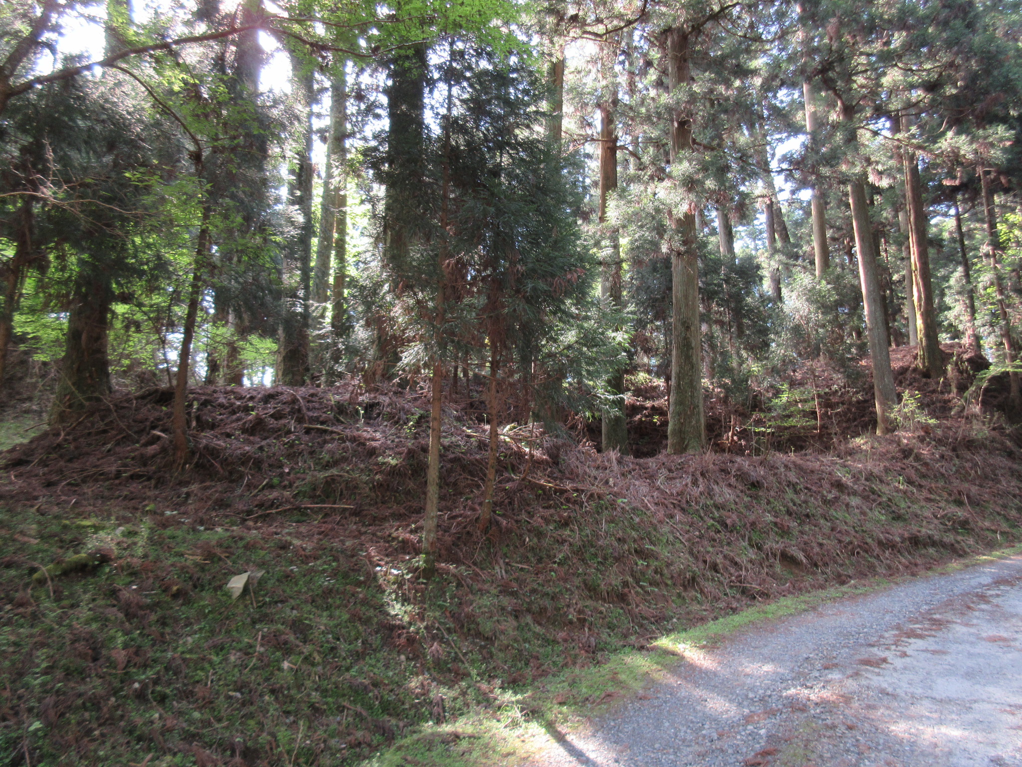
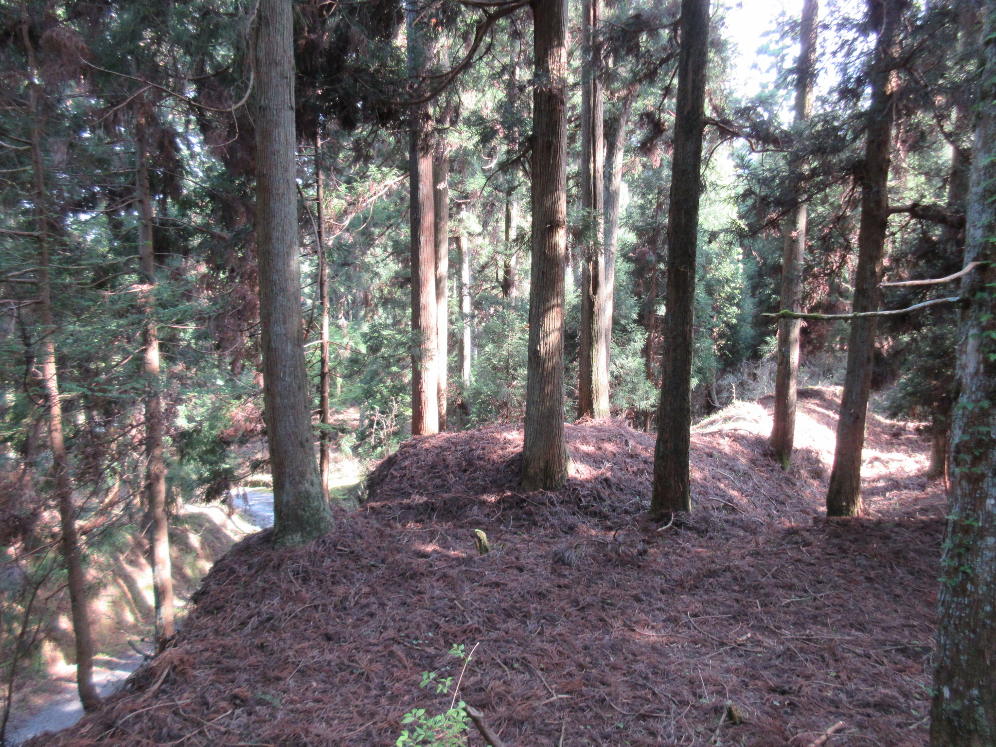
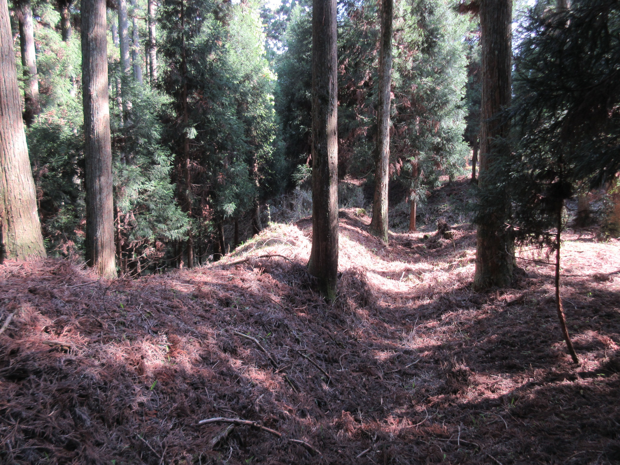
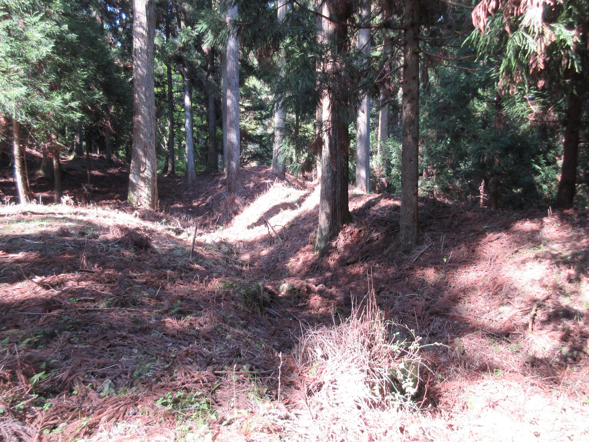
The Nishitani-toride (‘West Valley Fort’) refers to the fortified area of the temple-fortress of Enryakuji in the west. There is a peak along the ridge which separates Kyōto and Sakamoto with a monument on it. The monument appears to be a sōrin, or steeple which crowns a pagoda. Around this area there appears to be the remains of the fort, including terracing, kirigishi (shaved mountainside), dorui (earthen ramparts) ensconcing bailey spaces, and maybe even a koguchi (gate area). Viewed from the forest road below an area where I tentatively identified dorui looks like the earth was worked into terraces with ramparts atop. This must be part of the Nishitani-toride, I thought, but I don’t know how extensive it used to be.
.JPG)
.JPG)
.JPG)
| Castle Profile | |
|---|---|
| English Name | Enryakuji Nishitani Fort |
| Japanese Name | 延暦寺西谷砦 |
| Founder | Saichō |
| Year Founded | 778 |
| Castle Type | Mountaintop |
| Castle Condition | Ruins only |
| Historical Period | Pre Edo Period |
| Artifacts | Karabori, Dorui, Kuruwa, Koguchi, Kirigishi, &c. |
| Features | trenches |
| Visitor Information | |
| Access | Yase-Hieizanguchi Station on the Eizan Line; Eizan Cable Car; Eizan Ropeway; Hike for 30 minutes to Enryakuji or bus; or, Sakamoto-Hieizanguchi Station on the Keihan Ishiyama-Sakamoto Line; Sakamoto Cable Car; or, Direct Bus via Kyoto Bus no. 51 or Keihan Bus no. 57 from Kyoto Station to Hieizan-cho. |
| Visitor Information | Yase Route is 1,420 yen in total, including Eizan Railway and shuttle bus one-way; Sakamoto Cable Car is 870 yen; direct bus is 770 yen. |
| Time Required | 30 minutes |
| Location | Ôtsu, Shiga Prefecture |
| Coordinates | 35° 4' 33.67" N, 135° 50' 2.54" E |
|
|
|
| Admin | |
| Added to Jcastle | 2022 |
| Contributor | ART |
| Admin Year Visited | Viewer Contributed |


Enable comment auto-refresher