Fuchu Castle (Hitachi)
.JPG)
History
Fuchūjō was built over the ruins of the kokufu (provincial capital) of Hitachi Province. The kokufu is thought to have been built in 700 when Kudaranokonikishi Enpō was appointed governor of Hitachi. Hitachi-kokufu was besieged in 939 by Taira Masakado, and devastated.
In 1214, Daijō Suketomo built a fortified residence on the site. Expanding from this, a medieval fort was built on the site in the middle 14th century by Daijō Akikuni. For most of the medieval era the Daijō Clan seemed to have maintained the site. The Daijō, also called the Baba Clan, were based at Babajō, which would later become Mitojō.
In the Edo period, Fuchū-jin’ya was the base initially of smaller local clans who could not maintain full-fledged castles. From 1602 the Satake Clan was relocated from Hitachi to Akita, and the Rokugō took over, in turn relocated to Dewa-Honjō and replaced by the Minagawa Clan in 1623. In 1700, however, Tokugawa Yoritaka, the fifth son of Tokugawa Yorifusa, lord of Mito Domain, established a sub-domain here, and the Fuchū-jin’ya was (re)built. The fort stretched about 400m north to south, and 500m east to west. It had three principal baileys and at least three detached baileys. Baileys were separated by dry moats and earthen ramparts, of which only a few segments remain. A gate survives from the time of the jin’ya, constructed in 1828, though it has been moved slightly from its original position owing to road development.
Visit Notes
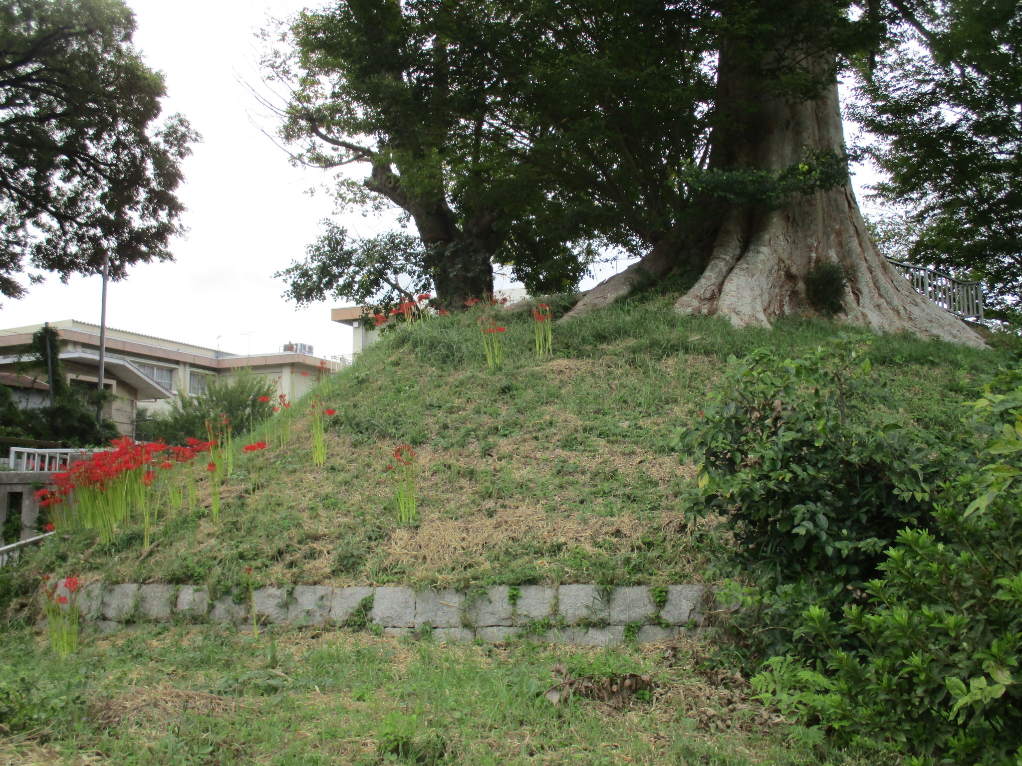
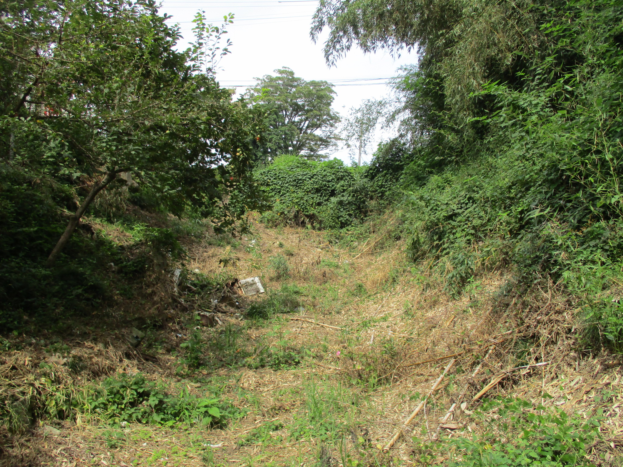
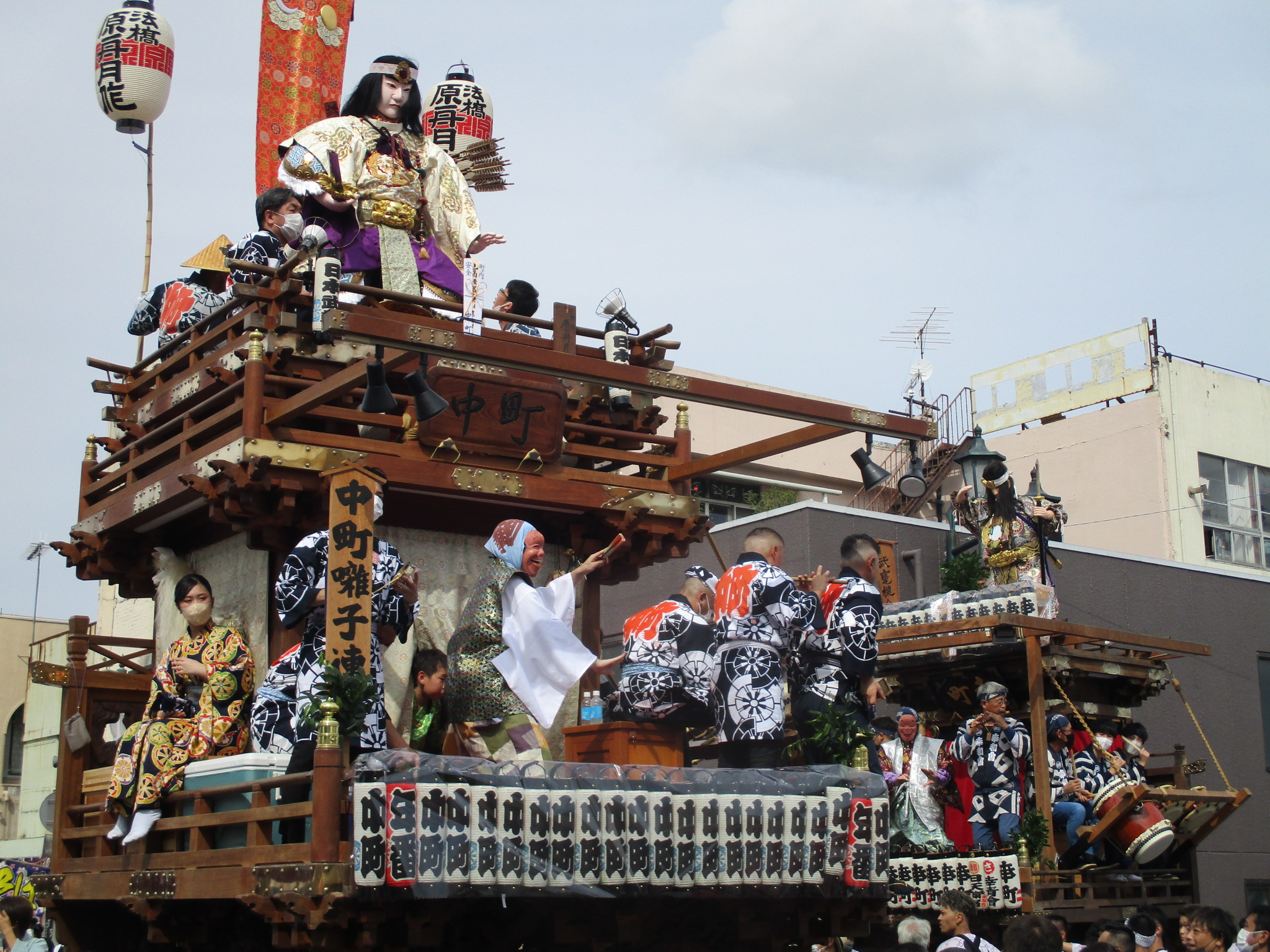
Of Fuchūjō, which mostly consist of earthworks though there is also an extant gate from the time of the jin’ya (Fuchūjō has a layered history which I discuss below), I found some dorui (earthen ramparts) and a karabori (dry moat system). Something was stirring as I entered the town of Ishioka, and things seemed lively, but I was a bit insensible as to what was going on, though I did note many stalls being set up. Just as I approached the extant castle gate, as though in co-ordination with my taking my first photograph, a festival float swung by. I considered this very fortuitous. Many people were watching the float and sitting in front of the gate. After leaving behind the growing crowds, I visited the castle ruins.
There are tall mounds of earthen ramparts surrounding Ishioka Elementary School, the remains of Ishioka-jin’ya, and a surviving gate has been relocated to in front of a public meeting hall nearby. Parts of the medieval structure of the castle are evident here and there, and the terrain is steep in parts, though suburbanisation has obscured much. The clearest remnant of Fuchūjō is a karabori, and grass and such in it has been cleared back so it is easier to see. I jumped down into it, of course. It goes a little way along before dropping into a climbing moat. I scrambled up the other side and found that dorui had been heaped up here to increase the height of the ramparts. There were flattened areas which could’ve been terraced baileys but the bamboo grew too thick to easily investigate. It seems more ruins may be found to the north where this moat system continued, but that is all private property and fenced off. Apparently there is a demaru (detached bailey) on the cliff to the north, but I couldn’t get close to the forested slope, and the top of the hill is in any case developed over with housing.

.JPG)
.JPG)
.JPG)
| Castle Profile | |
|---|---|
| English Name | Hitachi Fuchuu Castle |
| Japanese Name | 常陸府中城 |
| Alternate Names | Fuchū-jin'ya |
| Founder | Kudaranokonikishi Enpō; Daijō Suketomo; Tokugawa Yoritaka |
| Year Founded | 700; 1214; 1700 |
| Castle Type | Flatland |
| Castle Condition | No main keep but other buildings |
| Designations | Local Historic Site |
| Historical Period | Pre Edo Period |
| Artifacts | Karabori, Dorui, Gate |
| Features | gates, trenches |
| Visitor Information | |
| Access | Ishioka Station on the Jōban Line; 15 minute walk |
| Visitor Information | Access Limited |
| Time Required | 30 minutes |
| Location | Ishioka, Ibaraki Prefecture |
| Coordinates | 36° 11' 25.04" N, 140° 16' 12.68" E |
|
|
|
| Admin | |
| Added to Jcastle | 2022 |
| Contributor | ART |
| Admin Year Visited | Viewer Contributed |
| Friends of JCastle | |
| Shiro Meguri | |
| Shirotabi | |
| Yogo | |
| Jōkaku Hōrōki | |


Enable comment auto-refresher