Difference between revisions of "Hime Castle (Chikuma)"
(Created page with "{{Castle |English Name=Chikuma Hime Castle |Japanese Name=筑摩姫城 |Romaji Name=Chikuma-Himejō |Founder=Ogasawara Clan |Year Founded=Sengoku Period |Castle Type=Mountaint...") |
m (ART moved page Chikuma Hime Castle to Hime Castle (Chikuma)) |
(No difference)
| |
Revision as of 12:52, 5 June 2023
.JPG)
History
Himejō in Chikuma was a branch fortification of nearby Nishijō. See Nishijou Castle and Iinawa Castle for more information.
Visit Notes
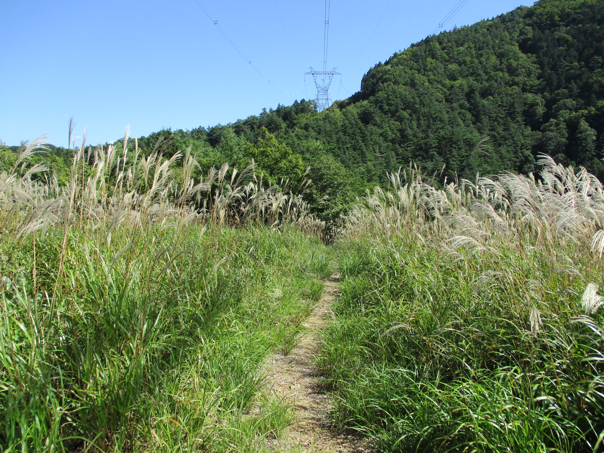
To get to Chikuma-Himejō I went up the slope directly until I came across a trail which took me the rest of the way. The site of this yamajiro (mountaintop castle) is now that of a pylon. It may seem that there are no ruins, but approaching from below it looks like dorui (earthen ramparts) surrounding a bailey. The peak has been carved (kirigishi) and rendered steep. Beneath the ramparts is a narrow lip like a ring bailey. In the middle of the ramparts where the trail runs is a gap which may have been the site of a gate. Beneath here is what looks like a climbing trench. All of these features are better appreciated approaching from below from the direction of the Yamanokami Nature Park. I could not discern much on the otherside of the fort. The contours of the fort may have eroded with time or been disturbed when the pylon was constructed. This site is quite minor and should probably only be visited (if at all) as part of a wider exploration of the Iinawajō complex of fortifications. Himejō is definitely the type of site where the effort is its own reward .
| Castle Profile | |
|---|---|
| English Name | Chikuma Hime Castle |
| Japanese Name | 筑摩姫城 |
| Founder | Ogasawara Clan |
| Year Founded | Sengoku Period |
| Castle Type | Mountaintop |
| Castle Condition | Ruins only |
| Historical Period | Pre Edo Period |
| Artifacts | Kuruwa, Hori, Obikuruwa, Dorui, Kirigishi, Tatebori |
| Features | trenches |
| Visitor Information | |
| Access | Shiojiri Station on the Chūō Main Line; 60 minute walk to trail head, or descent from Nishijōjō |
| Visitor Information | 24/7 free; mountain |
| Time Required | 20 minutes |
| Location | Shiojiri, Nagano Prefecture |
| Coordinates | 36° 5' 0.28" N, 137° 57' 37.66" E |
|
|
|
| Admin | |
| Added to Jcastle | 2021 |
| Contributor | ART |
| Admin Year Visited | Viewer Contributed |


Enable comment auto-refresher