
History
Imotojō is said to have been one of the castles used by Shibata Katsuie to surround and besiege Namazue Castle, the castle of the Namazue Clan who supported the Rokkaku during Oda Nobunaga’s campaigns against them. Another such castle, located toward Namazuejō but very close to Imotojō was Oumi Nakato Castle. Nakatojō appears to have very little in way of remains, but Imotojō has much more. Imotojō was a hirayamajiro-gakejiro (clifftop castle) built on the northern terrace of the Echi River plain, with developed defensive features such as dry moats, ramparts and multiple baileys. So it seems more elaborate than a jinshiro (encampment used whilst besieging a castle) like Nakatojō, and so perhaps it was built before Oda Nobunaga’s invasion by the Ogura Clan who were dominant in Echi Distrct and built nearby Aoyamajō too. That would make Imotojō a satellite castle of Oumi Ogura Castle before being taken over and used by Shibata Katsuie. That would also mean that Imotojō was likely attacked along with Ogurajō by the Rokkaku in 1570 during their punitive campaign against the Ogura for betraying them in their fight with Nobunaga.
Visit Notes
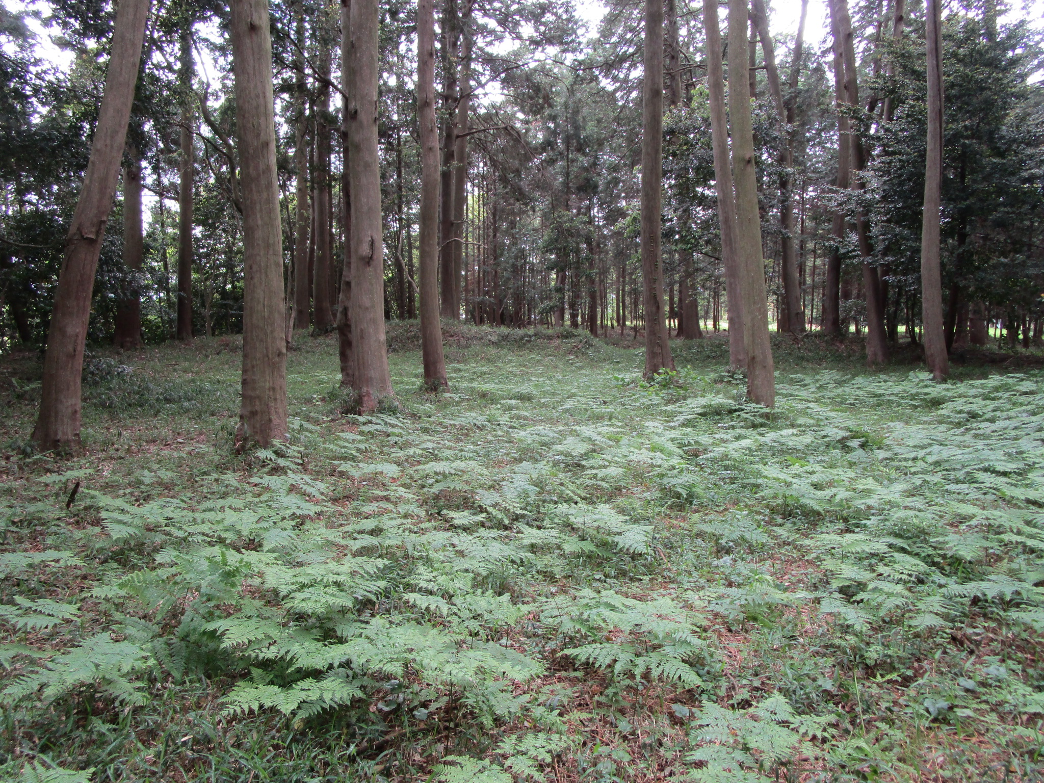
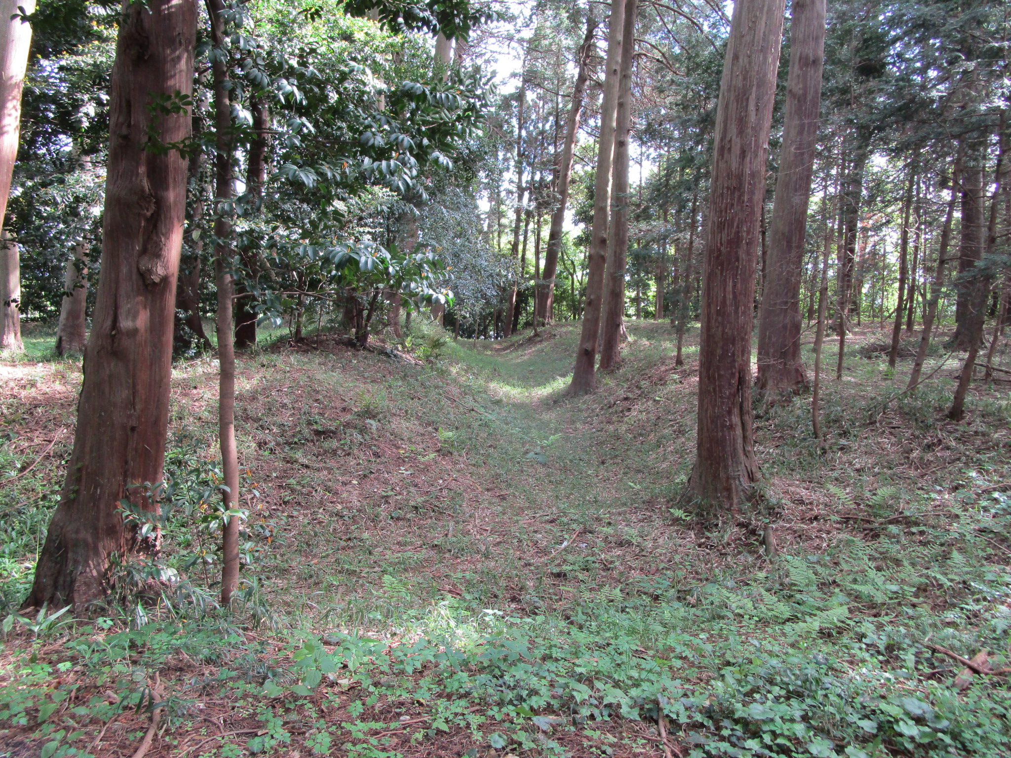
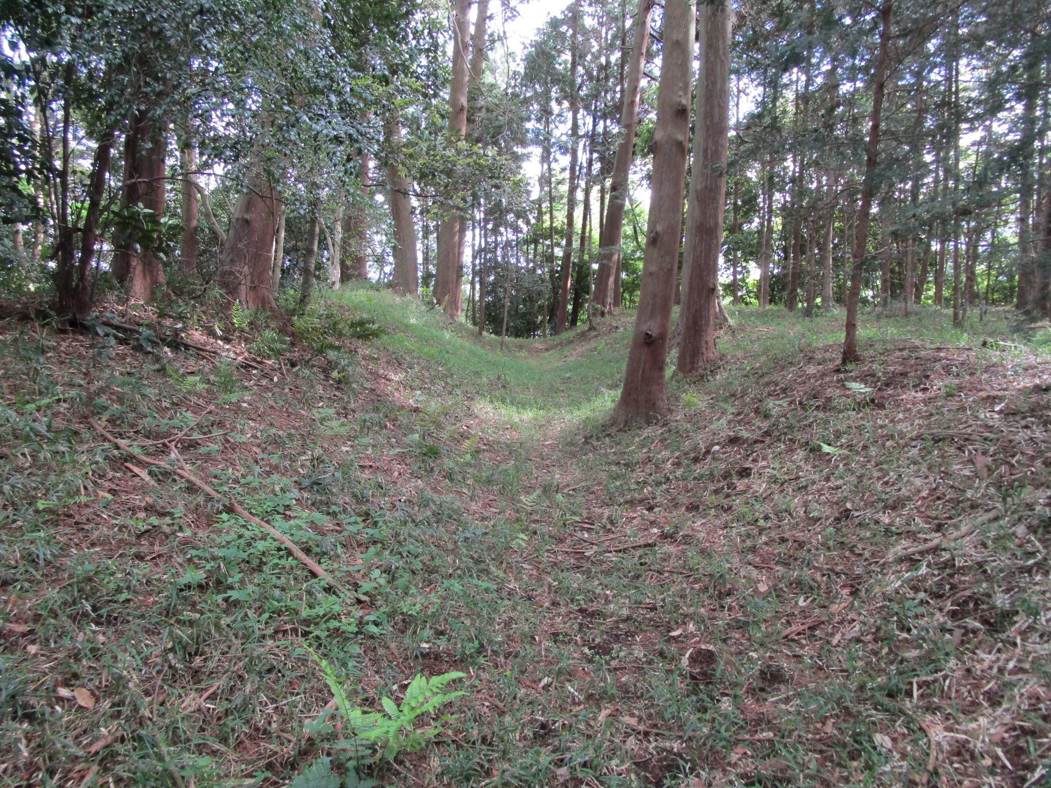
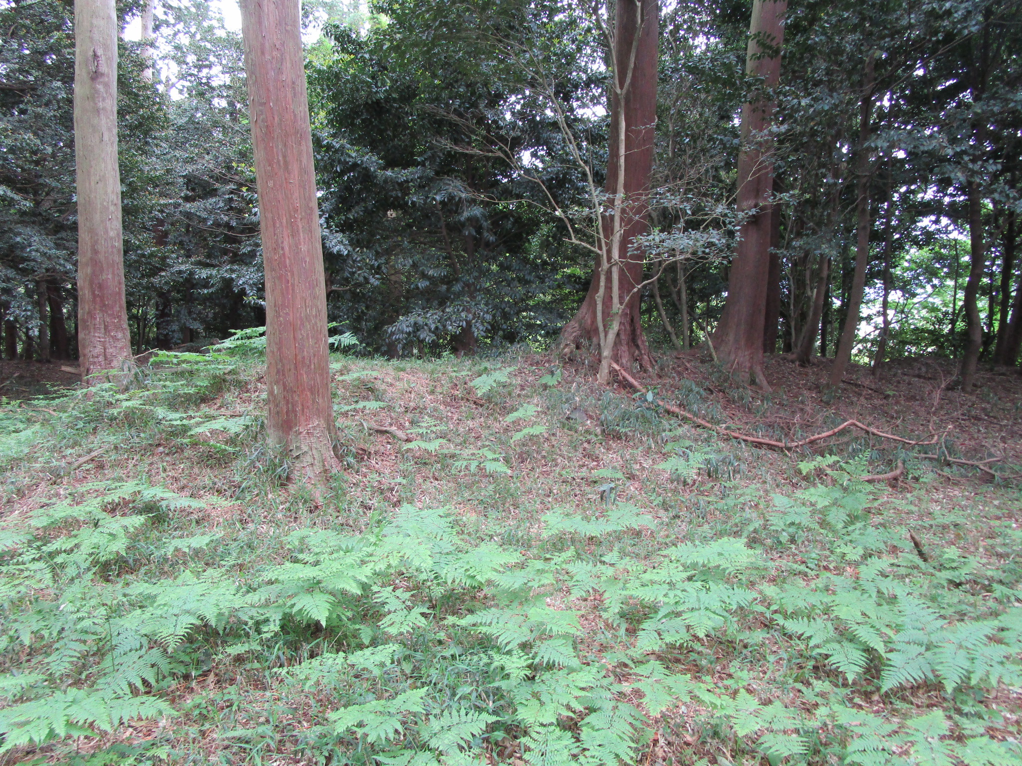
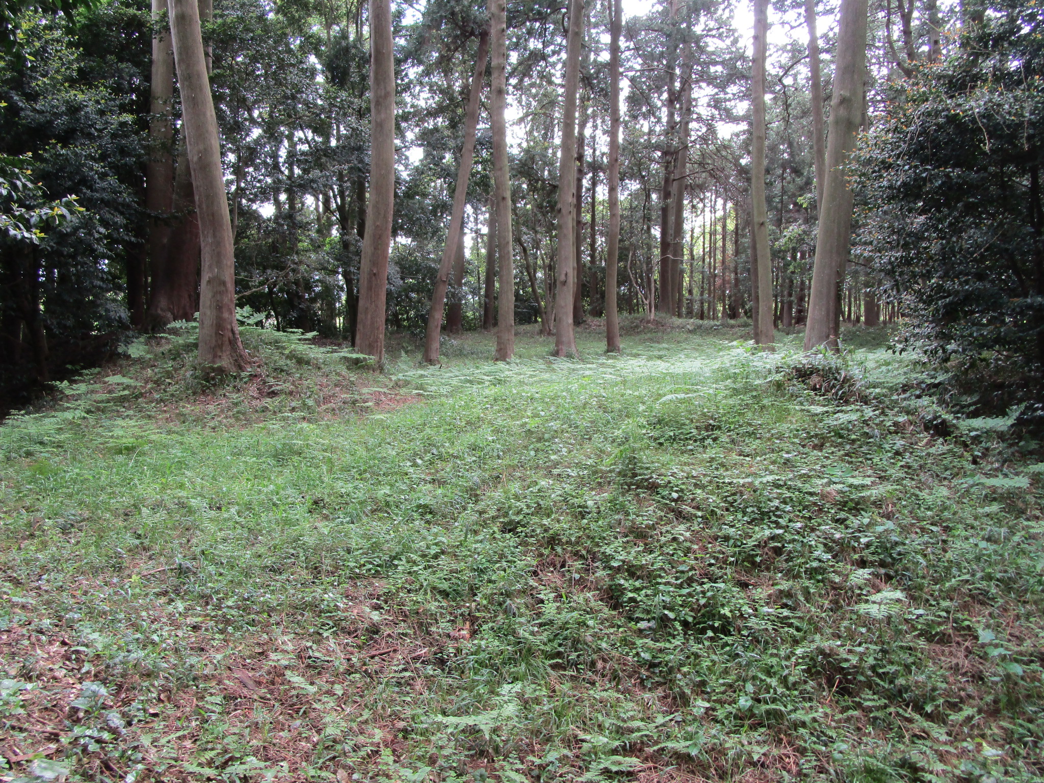
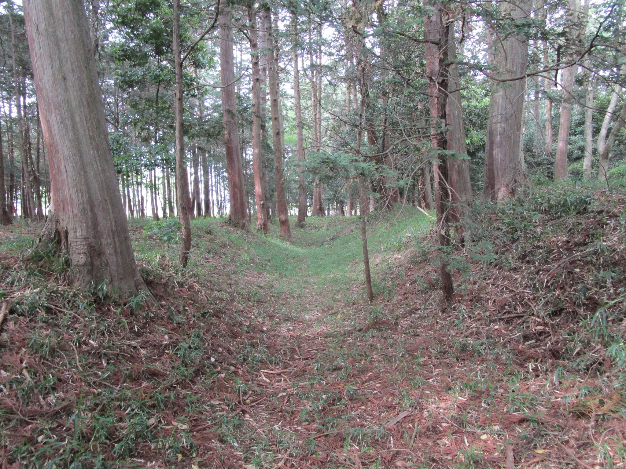
Imotojō is a clifftop earthworks castle ruin featuring dorui (earthen ramparts), karabori (dry moats), tatebori (climbing moats), and other earthworks. I believe I identified an umadashi (barbican) structure too. The shukuruwa (main bailey) is prominent because of the dorui surrounding it. The karabori further surrounds it on three sides, excepting the cliff side, and the ends of the moat terminate there and become tatebori. The site is forested but decently maintained. It seems that the main hall of Kasuga Shrine has been built into the adjacent cliff side.


| Castle Profile | |
|---|---|
| English Name | Oumi Imoto Castle |
| Japanese Name | 近江井本城 |
| Founder | Ogura Clan; Shibata Katsuie |
| Year Founded | Sengoku Period |
| Castle Type | Hilltop |
| Castle Condition | Ruins only |
| Historical Period | Pre Edo Period |
| Artifacts | Dorui, Tatebori, Karabori, Koguchi, Umadashi |
| Features | trenches |
| Visitor Information | |
| Access | Yōkaichi Station on the Kotō-Ōmi Line; 10 minute drive or 70 minute walk |
| Visitor Information | Free; 24/7; Forest |
| Time Required | 30 minutes |
| Location | Higashi-Oumi, Shiga Prefecture |
| Coordinates | 35° 6' 14.69" N, 136° 14' 58.60" E |
|
|
|
| Admin | |
| Added to Jcastle | 2021 |
| Contributor | ART |
| Admin Year Visited | Viewer Contributed |
| Friends of JCastle | |
| Hōrōki | |


Enable comment auto-refresher