Sengoku Yakata

History
In 1622 Sengoku Tadamasa was relocated from Komorojō to Uedajō. His territory included this area, which in 1669 Sengoku Masākira built a jin'ya here to administer. This "sub-domain" was valued at 2,000 koku, later increased to 2,700 koku, and contained the villages of Yazawa, Shimosato, Akasaka, Urushido, Iwashimizu, Koida, Mori and part of Hayashino-gō (gō = township / collection of villages). This is a fertile area located to the east of the Kamikawa River. In 1706 Sengoku Clan was relocated to Izushijō, but the branch at the Sengoku-yakata remained in place and governed until the Meiji Restoration.
Visit Notes
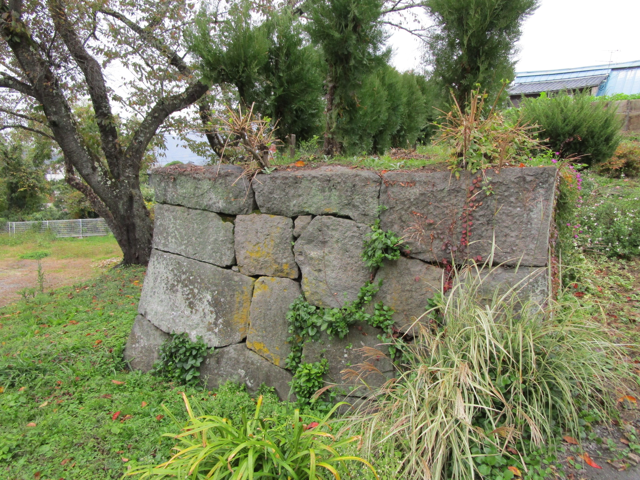
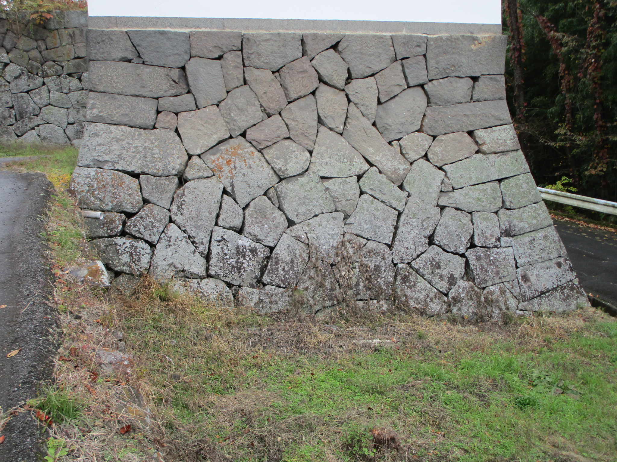
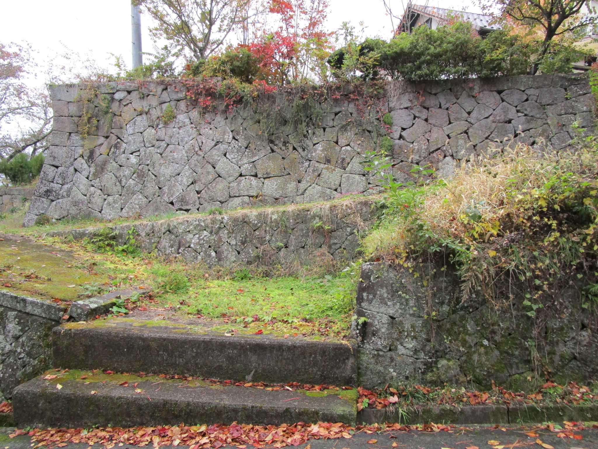
Yakata usually refers to a medieval fortified manor hall, but in fact this is the site of an Edo Period jin'ya or daikansho, a fortified administrative compound used to govern smaller territorial holdings. I was impressed by the ishigaki (stone-piled ramparts). These beautiful stone walls are the remains of the jin'ya. One platform of piled stone looks like it could've served as a turret foundation. Atop is a storehouse structure which has been "castellated" and has shachihoko (鯱) on the roof. I'm not sure this qualifies as a reconstruction but it looks great.


| Castle Profile | |
|---|---|
| English Name | Sengoku Yakata |
| Japanese Name | 仙石館 |
| Alternate Names | Sengoku-daikansho, Sengoku-jin'ya |
| Founder | Sengoku Masākira |
| Year Founded | 1669 |
| Castle Type | Flatland |
| Castle Condition | Ruins only |
| Historical Period | Edo Period |
| Artifacts | Ishigaki |
| Features | stone walls |
| Visitor Information | |
| Access | Ueda Station on the Shinano Railway; Sugadaira Bus from Ueda Station No.3 Bus Stop |
| Visitor Information | Free; 24/7 |
| Time Required | 20 minutes |
| Location | Ueda, Nagano Prefecture |
| Coordinates | 36° 24' 47.95" N, 138° 18' 29.70" E |
|
|
|
| Admin | |
| Added to Jcastle | 2020 |
| Contributor | ART |
| Admin Year Visited | Viewer Contributed |


Enable comment auto-refresher