Difference between revisions of "Sakura Castle (Suwa)"
| Line 3: | Line 3: | ||
|Japanese Name=諏訪桜城 | |Japanese Name=諏訪桜城 | ||
|Romaji Name=Suwa-Sakurajō | |Romaji Name=Suwa-Sakurajō | ||
| + | |Alternate Names=桜ヶ城 | ||
|Founder=Kanasashi Clan | |Founder=Kanasashi Clan | ||
| + | |Year Founded=Sengoku Period | ||
|Castle Type=Mountaintop | |Castle Type=Mountaintop | ||
|Castle Condition=Ruins only | |Castle Condition=Ruins only | ||
| Line 13: | Line 15: | ||
|City=Shimo-Suwa | |City=Shimo-Suwa | ||
|Prefecture=Nagano Prefecture | |Prefecture=Nagano Prefecture | ||
| − | |Notes=Suwa-Sakurajō was a nice little site to visit. There is the shukuruwa (main bailey) with an old look-out which can't be too different from a | + | |Notes=Suwa-Sakurajō was a nice little site to visit. There is the shukuruwa (main bailey) with an old look-out which can't be too different from a structure which would've been likely used at the castle. Looking on the hillside I found it terraced with minor baileys. Since the trees have been cut back and the site is cultivated as a small park one can easily see the shape of the castle ruins. I found some trenches in the woods beyond the park but they were difficult to pick out from amongst the undergrowth and fallen leaves. I don't know where Sakurajō got its name - 'Cherry Blossom Castle' - but it is appealing. |
|History=Sakurajō was built as a satellite fortification of Yamabukijō by the Kanasashi Clan. It is not so high up and therefore accessible, but due to the elevation nonetheless commands an excellent view of Lake Suwa and its northern plains. | |History=Sakurajō was built as a satellite fortification of Yamabukijō by the Kanasashi Clan. It is not so high up and therefore accessible, but due to the elevation nonetheless commands an excellent view of Lake Suwa and its northern plains. | ||
|Year Visited=Viewer Contributed | |Year Visited=Viewer Contributed | ||
| Line 19: | Line 21: | ||
|GPSLocation=36.07926, 138.0915 | |GPSLocation=36.07926, 138.0915 | ||
|Contributor=ART | |Contributor=ART | ||
| + | |FriendsLinks={{FriendsLinks | ||
| + | |FriendWebsiteName=Jōkakuzukan | ||
| + | |FriendWebsiteURL=http://jyokakuzukan.la.coocan.jp/016nagano/075sakura/sakura.html | ||
| + | }}{{FriendsLinks | ||
| + | |FriendWebsiteName=Oshiro Tabi Nikki | ||
| + | |FriendWebsiteURL=http://www.oshiro-tabi-nikki.com/suwasakura.htm | ||
| + | }} | ||
}} | }} | ||
Revision as of 21:26, 19 February 2023

History
Sakurajō was built as a satellite fortification of Yamabukijō by the Kanasashi Clan. It is not so high up and therefore accessible, but due to the elevation nonetheless commands an excellent view of Lake Suwa and its northern plains.
Visit Notes
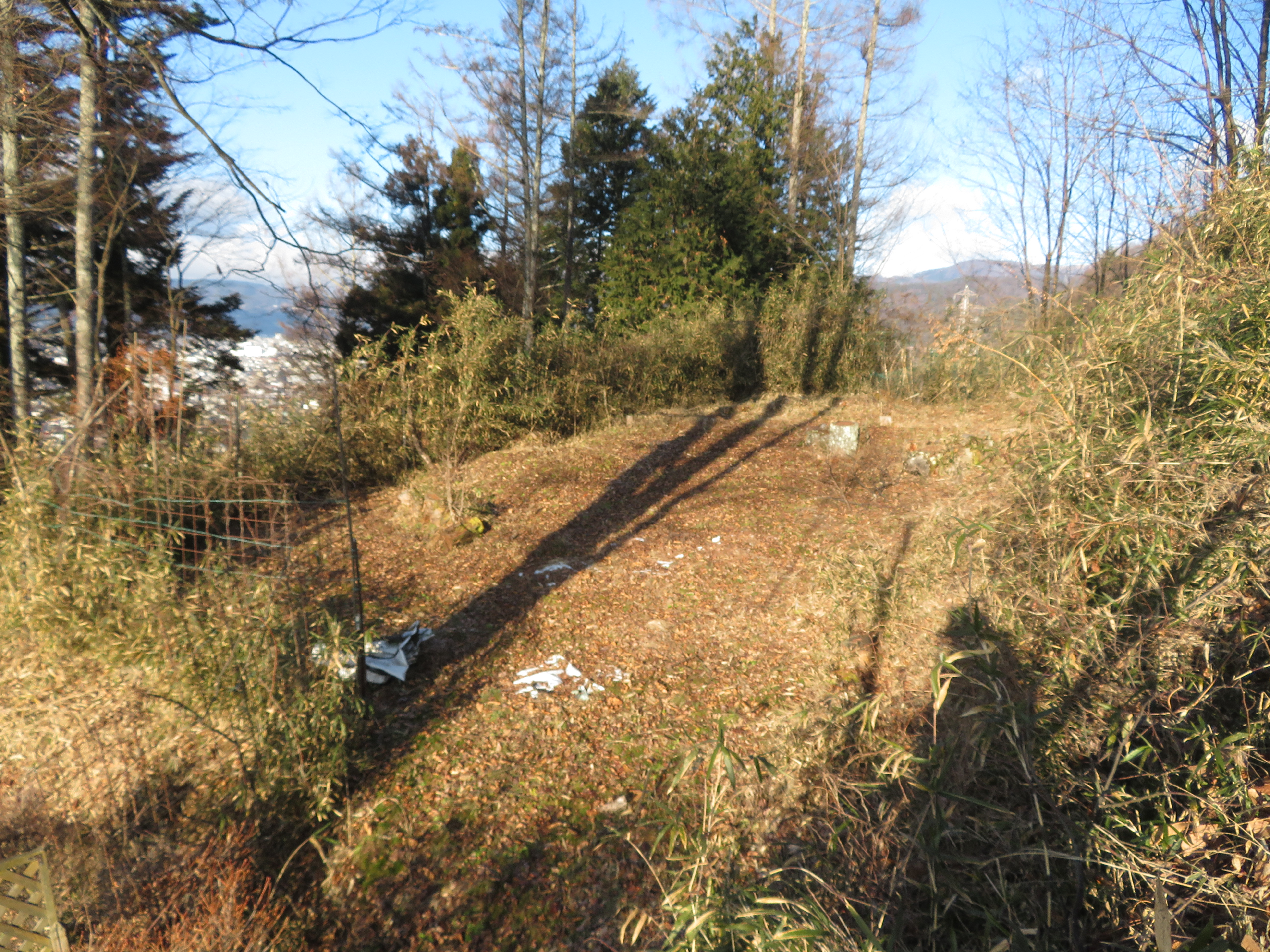
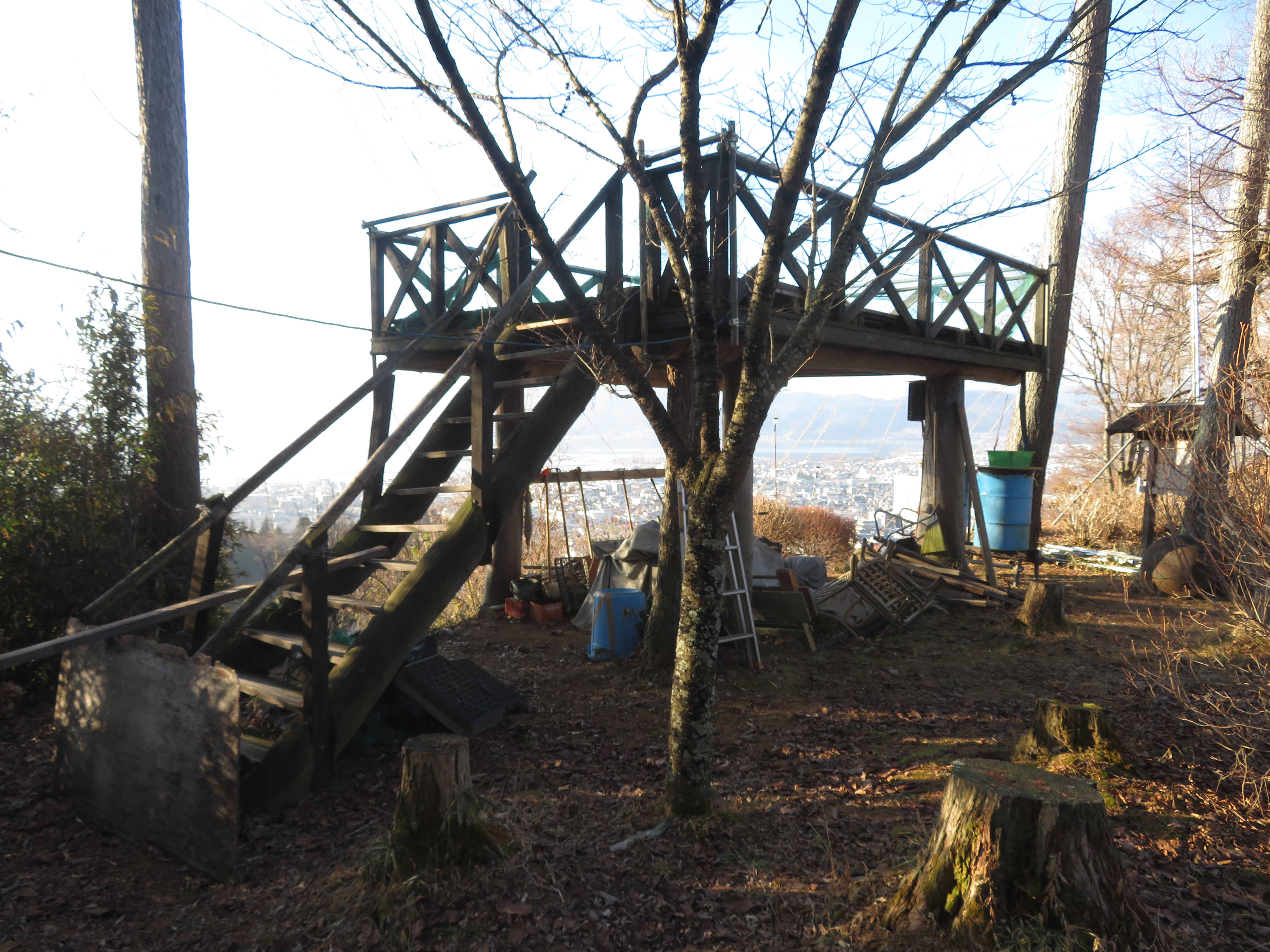
Suwa-Sakurajō was a nice little site to visit. There is the shukuruwa (main bailey) with an old look-out which can't be too different from a structure which would've been likely used at the castle. Looking on the hillside I found it terraced with minor baileys. Since the trees have been cut back and the site is cultivated as a small park one can easily see the shape of the castle ruins. I found some trenches in the woods beyond the park but they were difficult to pick out from amongst the undergrowth and fallen leaves. I don't know where Sakurajō got its name - 'Cherry Blossom Castle' - but it is appealing.


| Castle Profile | |
|---|---|
| English Name | Suwa Sakura Castle |
| Japanese Name | 諏訪桜城 |
| Alternate Names | 桜ヶ城 |
| Founder | Kanasashi Clan |
| Year Founded | Sengoku Period |
| Castle Type | Mountaintop |
| Castle Condition | Ruins only |
| Historical Period | Pre Edo Period |
| Features | trenches |
| Visitor Information | |
| Access | Shimo-Suwa Station on the Chuo Line; 25 minute walk |
| Visitor Information | 24/7 free |
| Time Required | 40 minutes |
| Location | Shimo-Suwa, Nagano Prefecture |
| Coordinates | 36° 4' 45.34" N, 138° 5' 29.40" E |
|
|
|
| Admin | |
| Added to Jcastle | 2020 |
| Contributor | ART |
| Admin Year Visited | Viewer Contributed |
| Friends of JCastle | |
| Jōkakuzukan | |
| Oshiro Tabi Nikki | |


Enable comment auto-refresher