Wakamiya Iriyama Castle
.JPG)
History
Wakamiya-Iriyamajō was a satellite fortification of Arato Castle along with Aratoshou Castle and Shou Castle.
Visit Notes
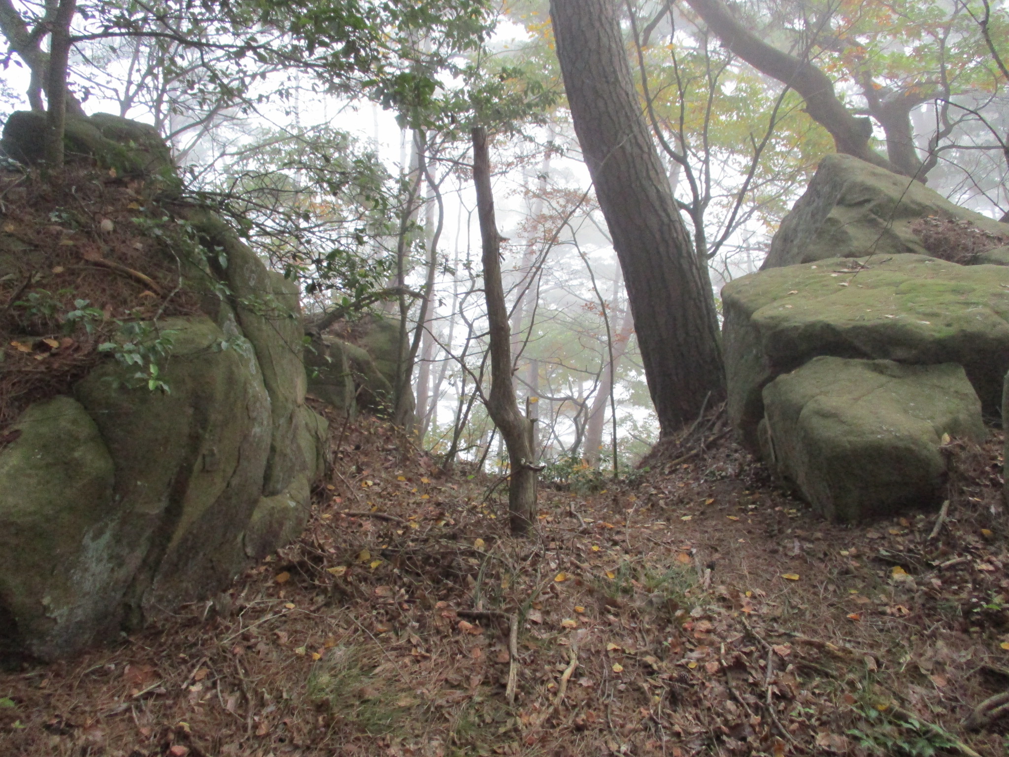
Further up from Aratojō and Aratoshōjō are the ruins of Wakamiya-Iriyamajō. I believe Wakamiya-Iriyamajō is so called to distinguish it from another castle called Iriyamajō some distance south. Wakamiya-Iriyamajō has a single principal bailey but also some minor baileys and koshikuruwa (hip baileys) terracing the mountain slope beneath it. There are also the remains of horikiri (trenches), particularly, most interestingly, in between large boulders that cling to the mountain ridge. Indeed the castle seems to have been built with using rocky outcroppings as part of its defences.
Climbing above Wakamiya-Iriyamajō will take one to Shōjō. There is a flat part of the ridge between the two sites with what may have been eathworks, and this may have been an extension of Wakamiya-Iriyamajō. Noticing this, I photographed them, but I was unsure. This flattened area may have been used as a garrison point between the two forts.


.JPG)
.JPG)
.JPG)
| Castle Profile | |
|---|---|
| English Name | Wakamiya Iriyama Castle |
| Japanese Name | 若宮入山城 |
| Founder | Yamada Clan |
| Year Founded | 1524 |
| Castle Type | Mountaintop |
| Castle Condition | Ruins only |
| Historical Period | Pre Edo Period |
| Artifacts | Tatebori, Kuruwa, Koshikuruwa, Horikiri |
| Features | trenches |
| Visitor Information | |
| Access | Togura Station on the Shinano Railway; 10 minute drive or 60 minute walk to Arato Castle (parking available); trail starts on the ridge behind Arato Castle |
| Visitor Information | 24/7 free; mountain |
| Time Required | 20 minutes |
| Location | Chikuma, Nagano Prefecture |
| Coordinates | 36° 28' 44.54" N, 138° 7' 52.82" E |
|
|
|
| Admin | |
| Added to Jcastle | 2021 |
| Contributor | ART |
| Admin Year Visited | Viewer Contributed |


Enable comment auto-refresher