.JPG)
History
Uzuhashijō served as a fort to guard the important Shio no Michi, a trade route used to bring salt from the coast into the interior of Honshū. From 1556 to the early 1580s the Takeda Clan ruled this area and issued passports. Before and after that it was controlled by the Uesugi Clan.
Visit Notes
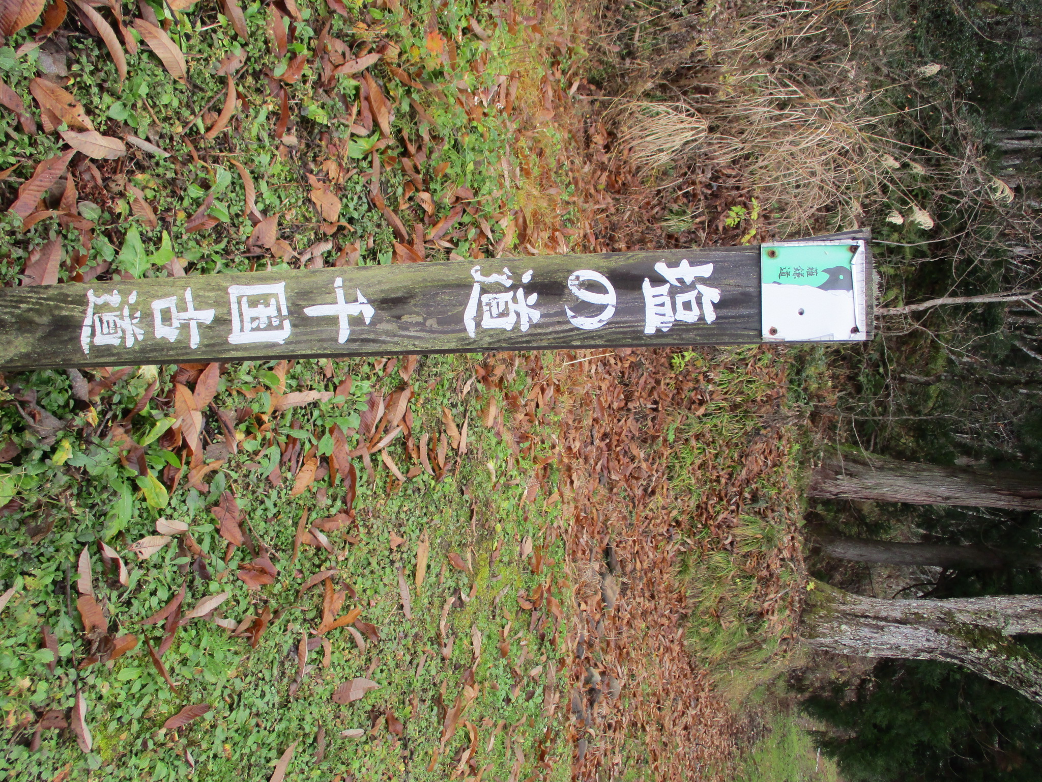
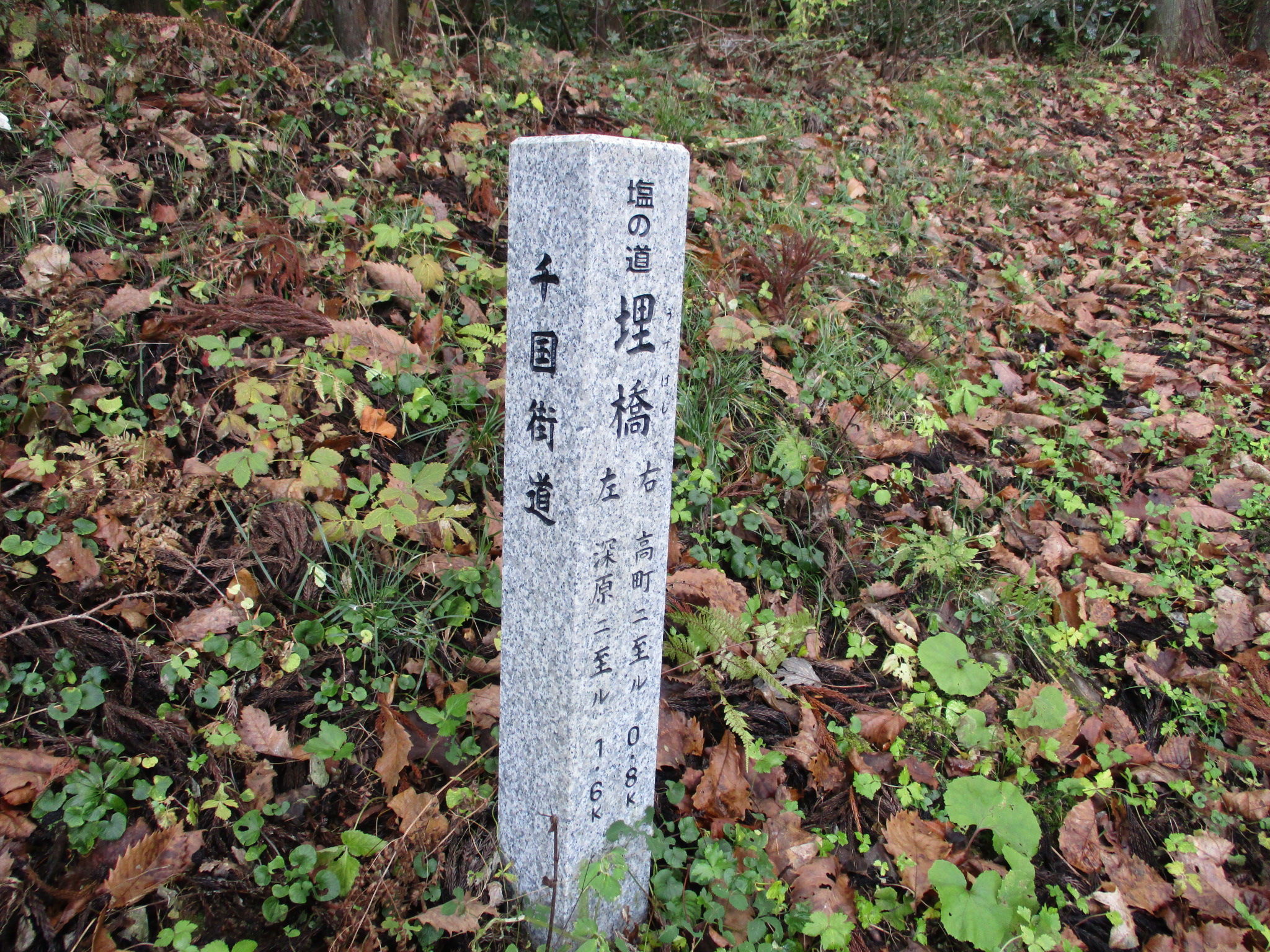
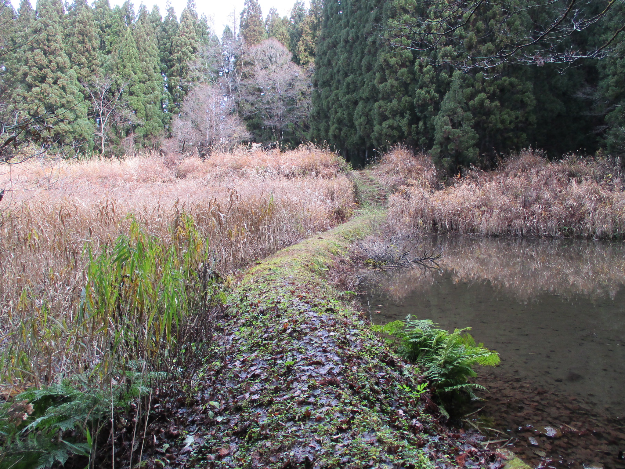
Little remains of Uzuhashijō, a fort built along the Salt Road, which ran from the Nunakawa (Itoigawa) area on the Japan Sea into the interior via northwest Shinano (Nagano). The name of the castle is marked differently on local brochures, but since they never bother to supply the reading (there are many possible variations, you see), I'm going to call the site Uzuhashijō since this is how I saw it listed originally. Uzuhashi is the name of the abandoned hamlet along the Salt Road (actually a dirt path) south of the fort site. The fort should be visited by following the Salt Road (Shio no Michi) trail. Because the site of the fort was cultivated subsequently, it's hard to tell what earthworks may relate to it; there are several embankments but they are probably just for terraced fields. However, the two embankments flanking eitherside of the road as it climbs between them is quite suggestive of where a gate and palisades would've stood. There is a marker for the castle here. If one follows a path to the left just before these ramparts one will find an earthen wier with a pond above it. There is a sharp rise in the earth at the end of this structure. This called me to it. When I climbed up some steps carved into the mud I found another marker for the castle, this one of wood and much older. Above was a mountain ridge climbing upward. Was it fortified? Building a fort directly below elevation is asking for trouble... But it seems Uzuhashijō's chief role was to protect the road and act as a checkpoint. The site today is seeded forest and muddy fields of reeds.


.JPG)
.JPG)
.JPG)
.JPG)
.JPG)
| Castle Profile | |
|---|---|
| English Name | Uzuhashi Castle (Azumi) |
| Japanese Name | 安曇埋橋城 |
| Alternate Names | 堅田城 |
| Founder | Uesugi Clan |
| Year Founded | Before 1556 |
| Castle Type | Mountaintop |
| Castle Condition | Ruins only |
| Historical Period | Pre Edo Period |
| Artifacts | Dorui |
| Features | |
| Visitor Information | |
| Access | Take the Shio no Michi trail from the north of Kita-Otari Station on the Ôito Line |
| Visitor Information | 24/7 free; mountain |
| Time Required | 20 minutes |
| Location | Otari, Nagano Prefecture |
| Coordinates | 36° 50' 38.36" N, 137° 55' 2.32" E |
|
|
|
| Admin | |
| Added to Jcastle | 2021 |
| Contributor | ART |
| Admin Year Visited | Viewer Contributed |


Enable comment auto-refresher