Kitatsumeno Fort
.JPG)
History
Kitatsumeno-toride is believed to have been used as a satellite fortification of Minowajō under the Nagano Clan but its origins are unclear. It is presumed that after the Battle of Wakadahara, in which Nagano Narimori lost to Takeda forces and retreated to Minowajō to rally his troops, Kitatsumeno-toride was occupied by the enemy. Minowajō would subsequently fall to Takeda forces and it is thought that Kitatsumeno-toride was abandoned after the death of Nagano Narimori. A samurai called Kitatsume was killed during the siege of Minowajō, and it is thought that he was the castellan of Kitatsumeno-toride.
Visit Notes
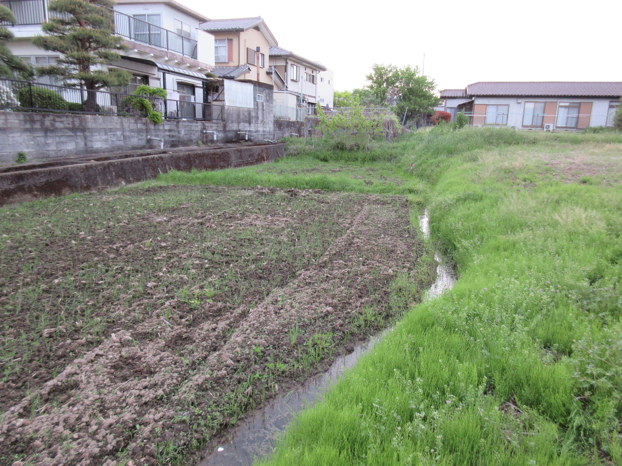
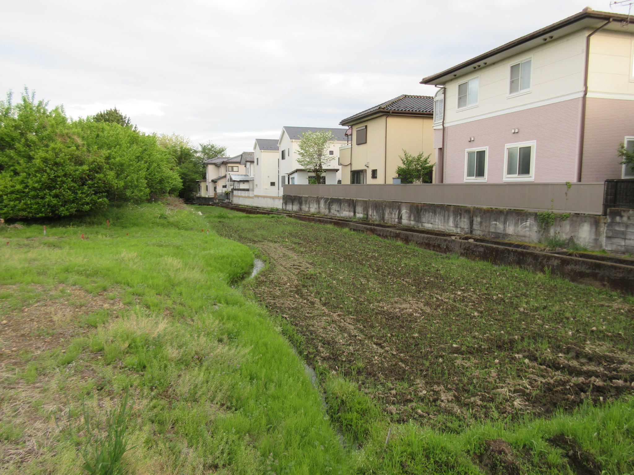
Little remains of Kitatsumeno-toride except for a former moat which is now used for narrow rice paddies. I followed this moat, which is set back and below fields and orchards which constitute the interior site of the fort, down to a small river, a tributary of the Ino River, which was used as the fort’s southern moat. This entire western outer moat segment can be followed and discerned down its length where it runs between houses and fields, but the rest of the castle site is buried under housing. Initially I failed to find anything, looking in the middle of the fort site where the inner moat was rather than at its western edge, but looking at satellite imagery I was able to discern the outer moat remains from above. There are no signs pointing to the castle ruins, and they are well-hidden. To the west of Kitatsumeno-toride was Kitāranami-toride, which is well preserved, and to the north was Yajimano-toride, of which nothing remains.
For related sites see Minowa Castle and Kitaaranami Fort.


.JPG)
.JPG)
.JPG)
.png)
| Castle Profile | |
|---|---|
| English Name | Kitatsumeno Fort |
| Japanese Name | 北爪ノ砦 |
| Founder | Nagano Clan; Kitatsume Clan |
| Year Founded | Sengoku Period |
| Castle Type | Flatland |
| Castle Condition | Ruins only |
| Historical Period | Pre Edo Period |
| Artifacts | Hori |
| Features | water moats, trenches |
| Visitor Information | |
| Access | Kita-Takasaki Station on the Shin’Etsu Main Line; 50 minute walk. |
| Visitor Information | 24/7; Free; Fields |
| Time Required | 20 minutes |
| Location | Takasaki, Gunma Prefecture |
| Coordinates | 36° 21' 51.16" N, 138° 58' 34.21" E |
|
|
|
| Admin | |
| Added to Jcastle | 2022 |
| Contributor | ART |
| Admin Year Visited | Viewer Contributed |
| Friends of JCastle | |
| Kojōshi | |
| Yogo | |


Enable comment auto-refresher