Tsubame Castle (Murakami Clan Fort Network)
.JPG)
History
Tsubamejō was part of a network of fortifications used by the Murakami Clan. The castellan of Tsubamejō is said to have been a local clansman called Shiojiri Gorōzaēmon. The area squeezed between the foot of the mountain and the Chikuma River is called Shiojiri. In the Edo period this area, including the slopes of the mountain, was intensively cultivated with mulberry plantations. The plantations on the mountain slope were terraced and the earth walls retained with walls of piled stone. Such structures were known as Yakkura, which I believe is a local term. These yakkura can be seen on the way up to the castle to this day, but do not represent castle ruins. Although ishigaki (stone-piled ramparts) are evident in several forts of the Murakami Renju Toride, Tsubamejō does not appear to be one of them. For more information on the Murakami Renju Toride see my profile on Kokuzōsanjō.
Visit Notes
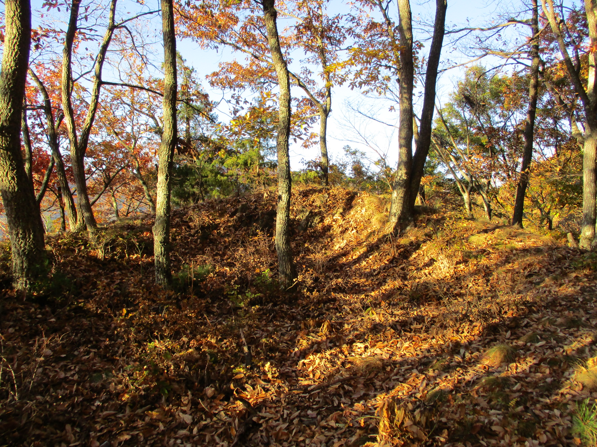
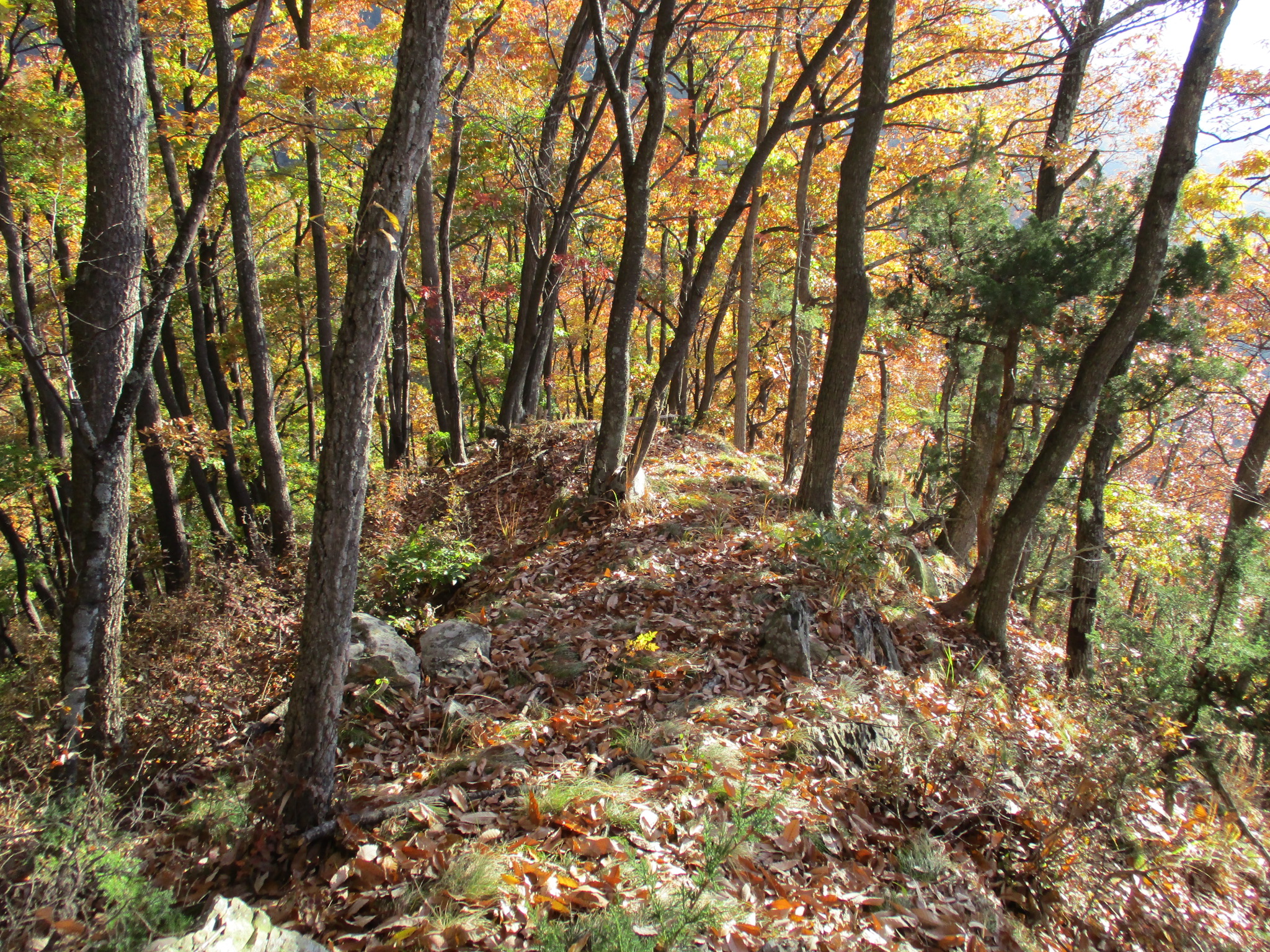
Tsubamejō (“Swallow Castle”) features dorui (earthen ramparts), kuruwa (baileys) and horikiri (trenches). To the rear of the shukuruwa (main bailey) is a double trench system bisecting the ridge. The shukuruwa is vaguely triangular, with dorui piled highest to the rear. The remains of additional baileys which terraced the mountain slope can be seen below. There is another horikiri between the shukuruwa and ninokuruwa (second bailey). The ninokuruwa also has a koshikuruwa (straddling bailey) located slightly beneath it.
I had intended to visit Tsubamejō after visiting Kemurinojō, which sits right above it, last year, but I followed down the wrong path and so exited the ridge too soon, missing it, by which time it was already getting dark. This time I approached from below. I found some trails but there are none that go all the way to the castle, so eventually I just assaulted the thing directly. Because of fallen leaves my progress was slow, often taking one step just to slip back two. Proper hiking gear is a necessity in these situations. On the way back I “fell” down the slope, bouncing from tree to tree like an excited pinball. I descended the mountain via Kamishiojiri-jinja, a shrine with some ishigaki which provided in its causeway an easy way down. I walked along the road just a little to get to the causeway to Zama-jinja, another shrine. By the way, this area of Ueda has a lot of old and rustic architecture to appreciate.


.JPG)
.JPG)
.JPG)
| Castle Profile | |
|---|---|
| English Name | Tsubame Castle (Murakami Clan Fort Network) |
| Japanese Name | 村上燕城 |
| Founder | Murakami Yoshikiyo |
| Year Founded | Sengoku Period |
| Castle Type | Mountaintop |
| Castle Condition | Ruins only |
| Historical Period | Pre Edo Period |
| Artifacts | Horikiri, Dorui, Kuruwa |
| Features | trenches |
| Visitor Information | |
| Access | Access via Kamishiojiri-jinja, 10 minute walk from Nishi-Ueda Station on the Shinano Railway. Or descend from Kemurinojou, staying off the main trail and being careful not to take the first fork on the ridge down. |
| Visitor Information | 24/7 free; mountain |
| Time Required | 30 minutes |
| Location | Ueda, Nagano Prefecture |
| Coordinates | 36° 25' 16.72" N, 138° 12' 43.88" E |
|
|
|
| Admin | |
| Added to Jcastle | 2021 |
| Contributor | ART |
| Admin Year Visited | Viewer Contributed |
| Friends of JCastle | |
| Ranmaru | |


Enable comment auto-refresher