Torihara Fort
.JPG)
History
Torihara-toride may have served as a mountain redoubt for the Kyōraishiminbu-yashiki, a fortified residence of the Kyōraishi Clan who were feudal lords in the Hakushū area, or as a redoubt for the village of Torihara at the foot of the castle mount, but the origins and use of the fortification are not known for sure. It is also speculated that the fort was developed as a satellite fort of Sasao Castle, built by Takeda Nobutora. It became the site of Sekison Shrine in the Edo period, and the construction of the shrine is thought to have destroyed much of the remains of the castle.
Visit Notes
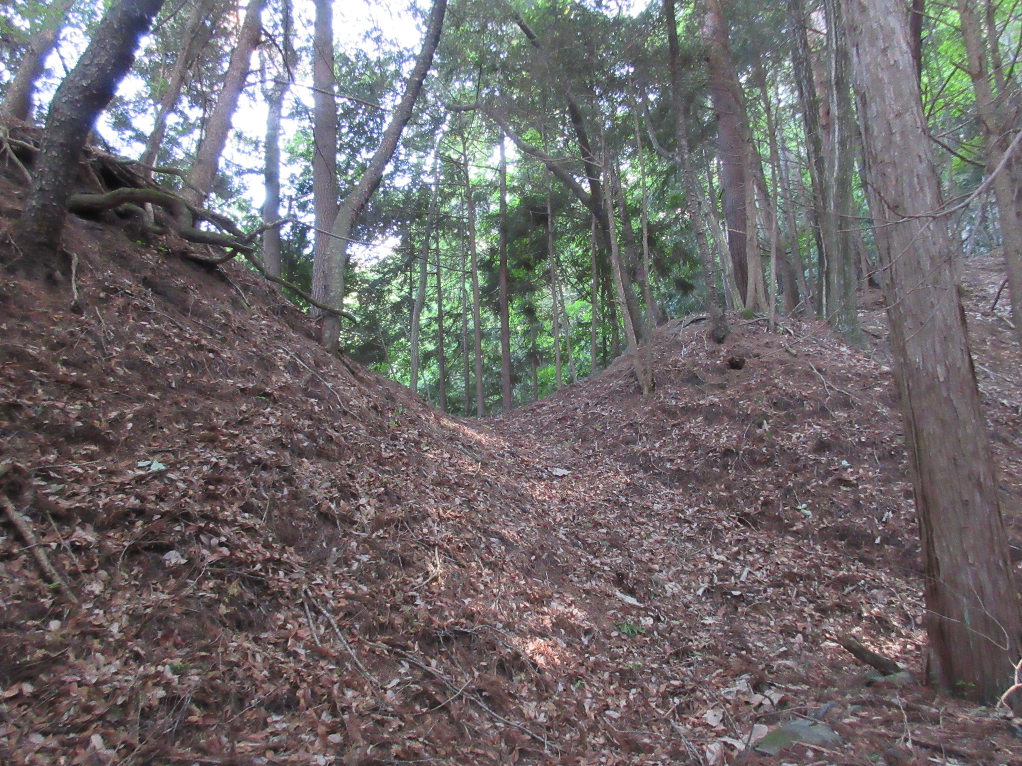
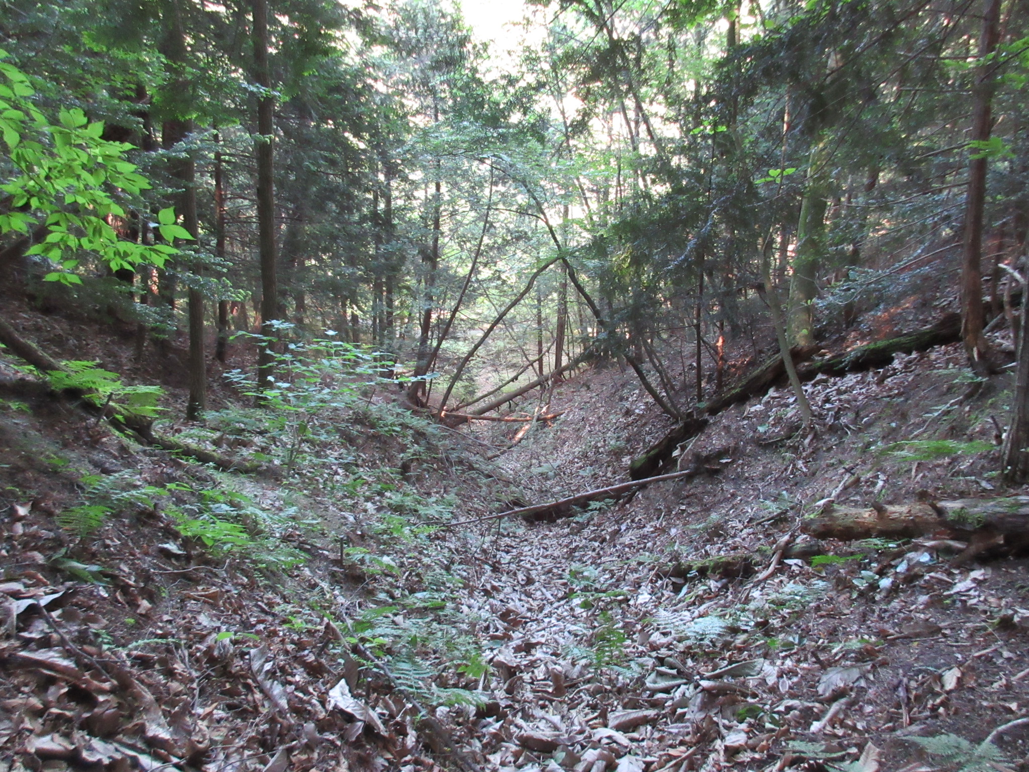
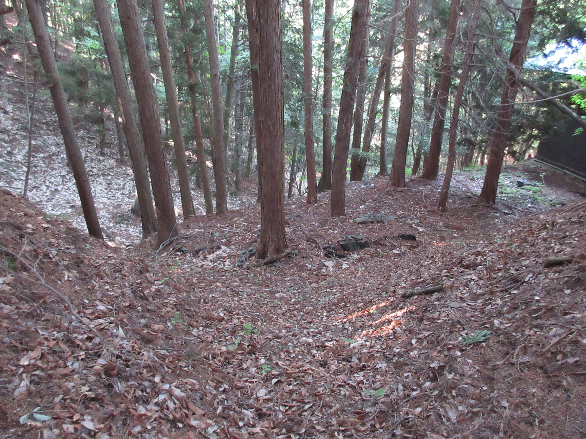
Torihara-toride is a mountaintop fort ruin with the remains of earthworks. Mostly prominently there is a horikiri (trench cut into the ridge) at the rear of the site. The site is now that of Sekison-jinja, a shinbutsu-shūgō (Kami-Buddha syncretism) shrine. To me it looks like the front-facing terrain of the flattened area containing the shrine hall is carved into steep embankments, a feature called kirigishi. Beneath here the hillside is terraced, a feature called koshi-kuruwa (sub-baileys). It is thought that the old bailey of the fort was excavated to build the shrine. Probably the shukuruwa (main bailey) was somewhat narrower than the current space with the shrine hall, and a lower second bailey was excavated until enough space for the shrine hall was cleared, leaving only part of the ridge and the rear trench; the ridge beside the shrine hall is what remains of the shukuruwa then. There is a trench-like excavation to the north of the shrine’s stone stairway, and this is thought to be where the fort’s ohte (main approach) was located, possibly with a gate built here. The ridge spur which descends to the shrine’s lower precincts looks worked, but I don’t know if this was for the fort or just the shrine.


.JPG)
.JPG)
.JPG)
.JPG)
.JPG)
.JPG)
.JPG)
| Castle Profile | |
|---|---|
| English Name | Torihara Fort |
| Japanese Name | 鳥原砦 |
| Alternate Names | 鳥原城 |
| Founder | Kyōraishi Clan |
| Year Founded | Medieval Era |
| Castle Type | Mountaintop |
| Castle Condition | Ruins only |
| Historical Period | Pre Edo Period |
| Artifacts | Horikiri, Kuruwa, Koshi-kuruwa |
| Features | trenches |
| Visitor Information | |
| Access | Nearest Station is Nagasaka on the Chūō East Line. |
| Visitor Information | 24/7 free; shrine |
| Time Required | 30 minutes |
| Location | Hokuto, Yamanashi Prefecture |
| Coordinates | 35° 49' 46.42" N, 138° 17' 18.02" E |
|
|
|
| Admin | |
| Added to Jcastle | 2022 |
| Contributor | ART |
| Admin Year Visited | Viewer Contributed |
| Friends of JCastle | |
| Kojōshi | |


Enable comment auto-refresher